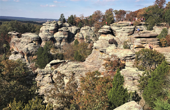
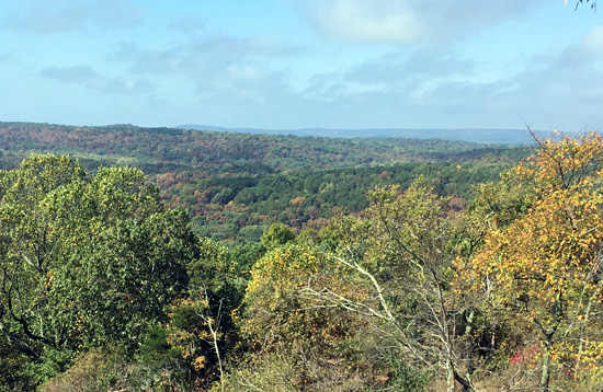
Garden of the Gods
Explore the rock formations, cliffs and trails of the most visited site in the Shawnee National Forest. See Camel Rock, Anvil Rock, Devil’s Smokestack and many other fascinating formations. Listed in USA Today as “One of Ten Great Places to Photograph”, the site is adjacent to a 3000 acre wilderness area which is relatively undisturbed. Connects to River to River Trail. Will appear on American the Beautiful 2016 quarter representing Illinois.
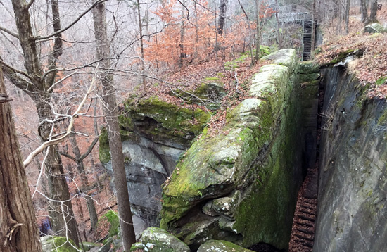
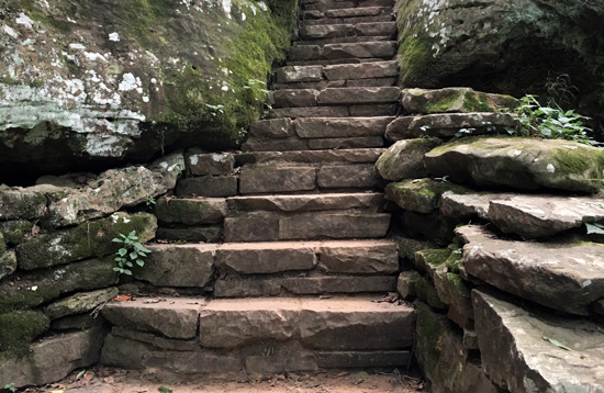
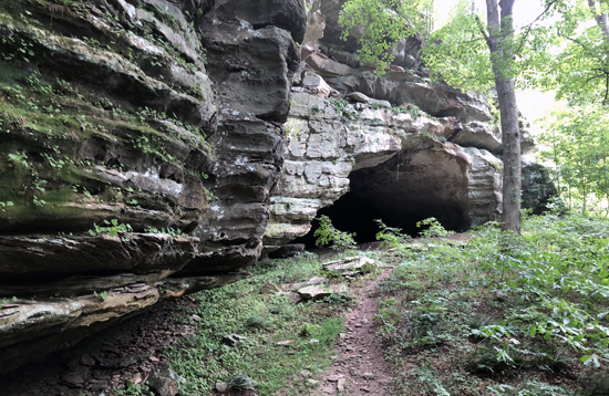
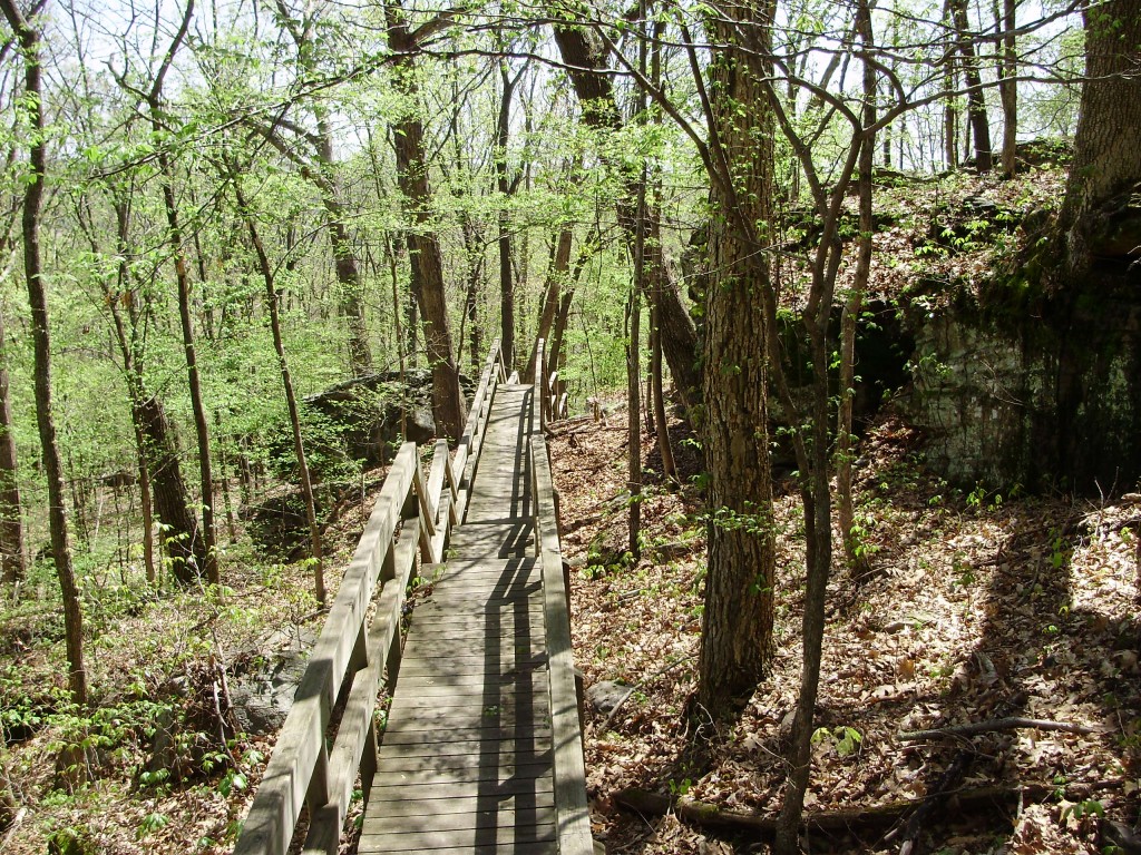
Rim Rock Recreational Trail
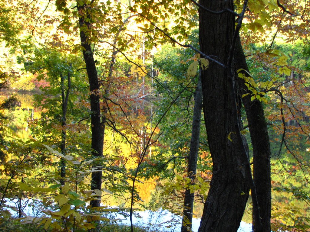
Hike the Rim Rock trail which meanders through native hardwoods, past the remains of an old Indian Wall. Take the rock stairway to the valley leading to a huge rock shelter bluff called Ox-Lot Cave. Pass through “Fat Man’s Misery”, a narrow passageway rough massive cliffs and huge boulders. Top trail is paved. Lower trail leads to Pounds Hollow Lake.
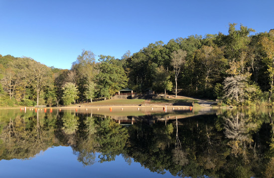
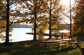
Pounds Hollow Recreation Area
A picturesque setting, Pounds Hollow campground and lake are tucked away amongst the Shawnee Hills, where you can relax and get away from it all. Completed in the early 1940’s, Pounds Hollow Lake is popular for the same reasons it was 60 years ago and continues to provide opportunities to picnic, fish, swim, camp and hike.
Cave-in-Rock State Park
Ride the only Illinois Ferry crossing the Ohio River and view the lifestyle of our Kentucky Amish neighbors. While you are in Marion, Kentucky visit Ben E. Clement Mineral Museum, home to an outstanding collection essays services reviews.com of minerals, gemstones, carvings, period journals, photographs, mining tools and more. Participate in an actual dig.
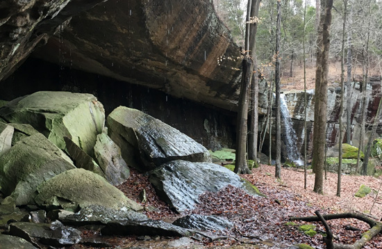
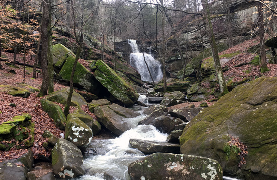
Jackson Falls
Jackson Falls offers many opportunities for technical climbing and is a beautiful scenic area on the Shawnee National forest. To reach Jackson Falls from Harrisburg, turn south on Highway 145 to Delwood. Turn right (west) toward Bell Smith Springs. Pass through Mccormick, then Zion Hill Church uk best essays.org. Turn left (south) on forest road 494. Road is rough until the unmarked recreation area on the right, just before the creek. There is an outhouse there and a bulletin board with information supplied by the Illinois Climbers’ Association. Camping is allowed here. A trail follows the top of the bluff (southeast) around to the “dog leg” where you can walk into the canyon, or you can tie up and rappel.
Burden Falls
An intermittent, seasonal stream spills over Burden Falls in a picturesque series of waterfalls with a total drop of about 100 feet and the greatest single drop a distance of around 20 feet. The Wilderness shares a boundary with Bay Creek Wilderness to the south, and both exemplify the scenic characteristics of the Shawnee Hills: sandstone ledges, bluffs and cliffs on which grow red cedar, farkleberry and blackjack oak. At the bottom of the bluffs, you will find greater soil depth supporting post oak and, as you move away from the cliffs, even deeper soil where white oak grow.
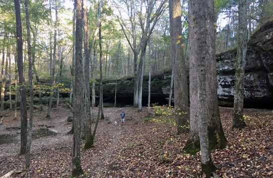
Bell Smith Springs
Bell Smith Springs is one of the most beautiful recreation areas the Shawnee National Forest has to offer. It contains a series of clear, rocky streams and scenic canyons bordered by high sandstone cliffs and an abundance of vegetation unique to Illinois. The trail system consists of eight miles of interconnected trails featuring strange and wonderful rock formations, such as Devil’s Backbone, Boulder Falls and a natural rock bridge. Hiking this system of trails is a favorite activity because of the rock features, scenic overlooks, hidden springs and lush flora and fauna.
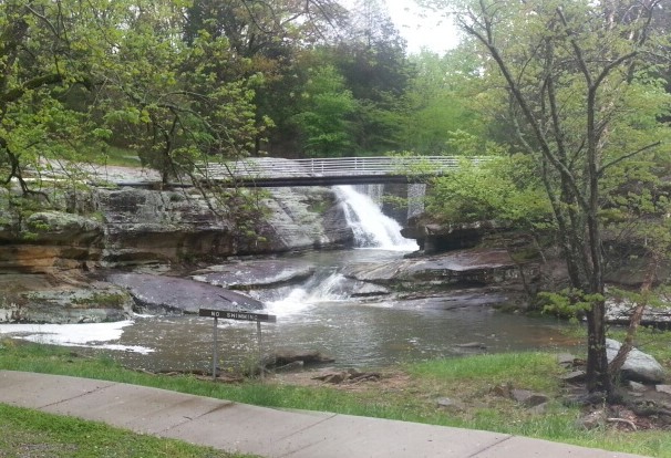
Dixon Springs State Park
786 acre state park situated on a giant block of rock . Cliffs, wet weather waterfalls, large boulders and a running stream are just some of the sights to see when hiking, picnicking or visiting this beautiful park. A modern swimming pool with a 45-foot water slide is provided for swimmer’s enjoyment. Chocolate Factory and ice crème parlor nearby.
One Horse Gap
Visualize an ancient Indian tribe passing through “One Horse Gap” a nearby narrow rock crevice that extends downward from the top of a sheer bluff near this 26-acre lake.
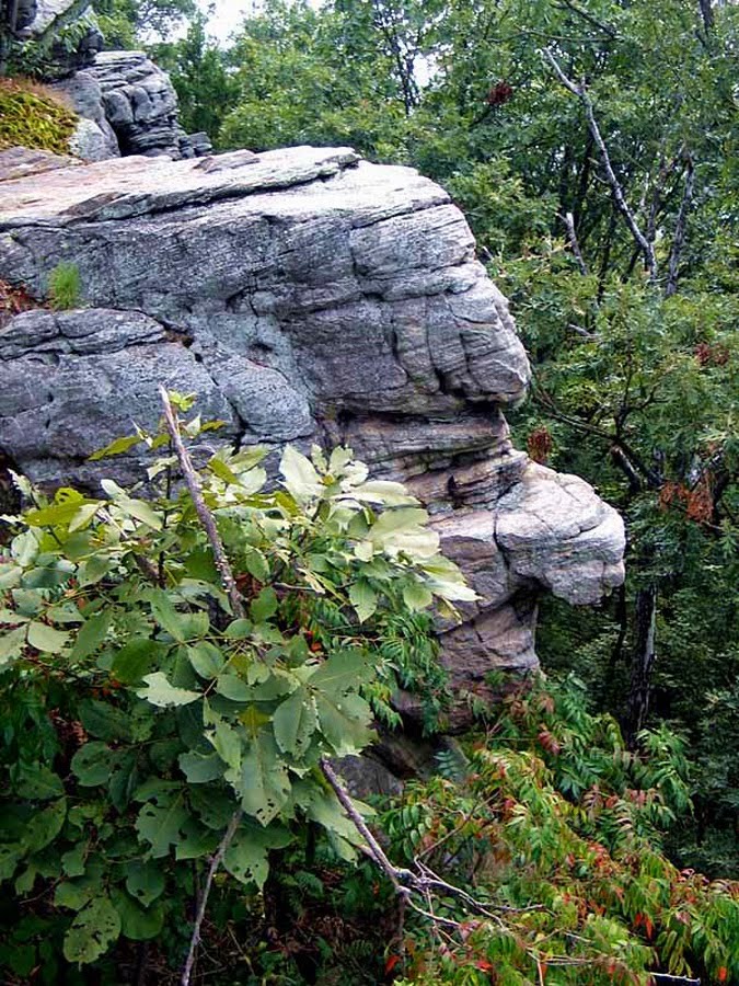
Ol' Stone Face
Stone Face is about ½ mile but strenuous at the end you are rewarded with scenic vistas and of course Stone Face. The Stone face Trail continues to Glen O Jones’ Lake for a total of about 3 miles. Ends at the Chief Tecumseh statue in the wildlife area of Glen O Jones. Marvel at nature’s handiwork. The likeness is one of the finest, most natural you will find. Stone face is north of the small town of Herod. Go North on Illinois Rt 34 to the town of Rudiment From here follow the signs to Stone Face Road, about 4 mile from Rudiment. The entrance to Stone Face is Forest Service road 150 and is about .25 miles long.
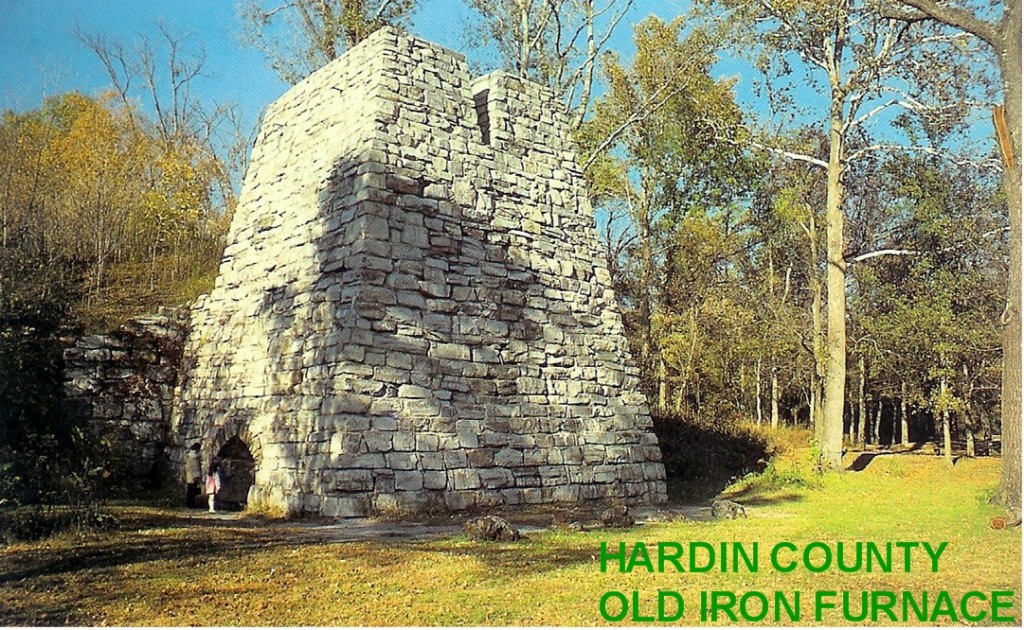
Illinois Iron Furnace
On the National Register of Historic Places, step back in time to Civil War days when “pig-iron” was smelted in the first charcoal-fired iron furnace in Illinois. Iron ore mined from the nearby hills was mixed with charcoal and smelted down to “pigs”. These were then shipped to Mounds during the Civil War and were used in constructing the Union Iron clad boats used to keep the rivers clear during the Civil War. Unwind in the secluded valley where you can picnic, hike and swim in the “ole swimmin’ hole”.
Lusk Creek / Indian Kitchen
Almost 5,000 acres of beautiful Shawnee Forest loaded with scenic canyons, beautiful streams, sandstone cliffs and trails for days. Many rare plants and lots of wildlife.
High Knob Lookout
Some of the best panoramic views of the Shawnee and a perfect view for sunsets. A couple highlight filled short hikes including an old “Indian Trail Tree” and beautiful green slot canyons and rock formations.
Millstone Bluff
National Historical Registry. Got its name from the millstone for pioneer mills dug from a small quarry on this hill. Before that however, it was a very interesting Mississippi Indian Village. (The same as is found in Cahokia) . Vistas, scenic. Near city of Glendale.
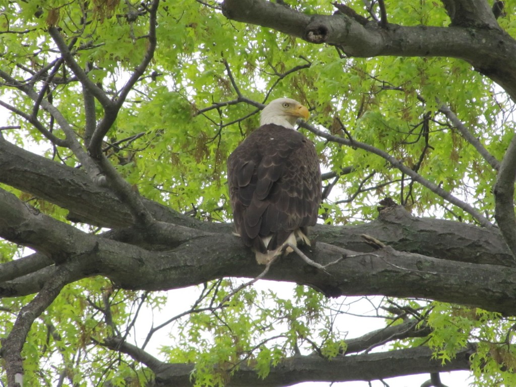
War Bluff Bird Sanctuary
The largest Illinois Audubon sanctuary, War Bluff Valley Sanctuary, is located in rural Pope County in southeastern Illinois. Adjoining the wilderness of the Shawnee National Forest, this nearly 500-acre sanctuary is home to a large variety of birds and mammals, as well as a great diversity of rare plants, including several species of native orchids. The purpose of the sanctuary is to protect the wildlife and habitat, and for research on populations and native species. War Bluff Valley Sanctuary is a place for birds and other creatures. It is also for people – people who respect and love wildlife and the land. Take Hwy. 146 north from Golconda, Illinois 3.5 miles to Bushwhack Road; turn left, follow Bushwack Road approximately 2 miles to the sanctuary entrance on right.
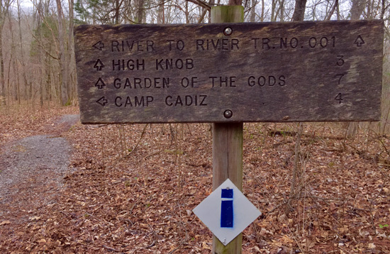
River to River Hiking and Equestrian Trail
The River to River Trail spans 160 miles from Battery Rock on the Ohio River to Devil’s Backbone Park in Grand Tower on the Mississippi River. 160 miles of Shawnee Forest scenery. Whether you’re experiencing Southern Illinois for the first time or have loved this area for years, there are many surprises along the trail. If you want to truly experience the Shawnee National Forest and Southern Illinois then the River to River Trail is for you.
Glen O Jones Lake and Saline County Conservation Area State Park
Wildlife Area, 5 miles southeast of Equality in southeastern Illinois, was the site of springs and wells that furnished brine for one of the two salt works. Although the springs and wells are not visible today, the area primarily is a recreational site. The initial acquisition of 524 acres of land was made in 1959 by the state of Illinois, and the total acreage now totals 1,270 acres, including a beautiful 105-acre lake.